Monday, June 11, 2012

10th June 2012: Isolated Supercell From Birth to Death

We woke up in Okarche, Oklahoma and after a good chat with Pete's buddy Dave about the day's weather set-up we decided to make our way northwards into Kansas and initially set up near Newton just north of Wichita. We had lunch there (at Braums - a great fast-food burger place that I reckon serves the greatest milkshakes on Earth). After that we drifted northwards to a place called Roxbury where we watched this isolated supercell thunderstorm break the capping inversion (the only storm that did on Sunday in central Kansas - so we felt very good about our forecast target working out for the day). I took a time-lapse of the storm developing...(I'll try to get it into HD at some point)...


After watching it from afar we drove closer to the base and got some really great structure, near Canton, Oklahoma. We drove under the anvil and saw some very well developed mammatus cloud...


And the rain free base (updraft of the storm - the bit of brighter coloring under the storm) along with a nicely tilted updraft - indicating a healthy supercell structure. You can also see the back-sheared anvil as well - the grey around the top of left of the picture with the blue sky underneath it...


We were enjoying taking some pics of this isolated cell...


We also got a very beautiful sunset through the edge of the storm under a corn field as well...


 The storm also looked as though it was trying to produce a small funnel at one point, but we were probably too far away to decipher whether it was a funnel or just scud cloud being sucked into the storm. 


  and this was a little later...


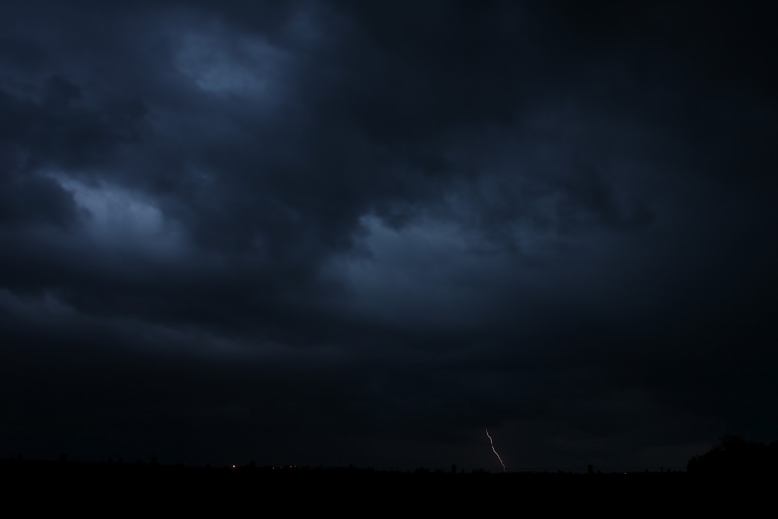
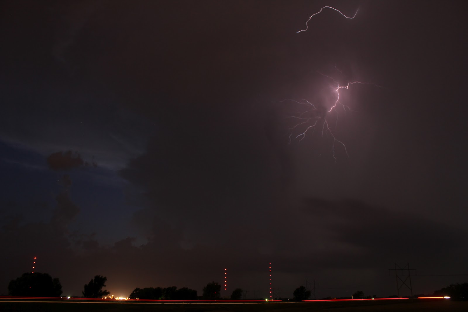
After dark we were treated to a nice lightning show for about half an hour before the storm completely collapsed. In fact, it was probably the fastest I have seen a storm go from a healthy looking supercell (in person and on radar) to almost nothing at all. So we were very lucky to be on it from start to finish. Here are a few lightning shots from just north-west of Wichita, KS.


Today we are heading southwards to play around with the remnants of this cold front that looks like it will be draped across southern Oklahoma and northern Texas along the Red River. Looks like storm may not break the cap/inversion until close to dark, so it may end up being another lightning day - but at least there will be something to chase.

Looking forward to the rest of our chase days, the tornado risk seems to be pretty low - however there appears there will be the risk of some thunderstorms/supercells on many of the days, so fingers crossed we will still see some nice storm structure.


Saturday, June 09, 2012

9th June 2012 - Travel Day...

Nothing much to report weather wise today. However, I will officially say it was my 4th day in a row to see lightning, as we saw in the distance some flashing of lightning along the sea-breeze front off of the coast of Texas in the Gulf of Mexico at around 5am this morning as we drove northwards out of SE Texas. This was my mother's final bit of advice to us before we left SE Texas in her car!  (Thanks Mom, by the way)...


Today we needed to drive to Okarache, Oklahoma (central OK) to meet up with fellow chase partner Pete and get in position for some potential chasing on Sunday afternoon/evening across parts of eastern Kansas.

Okarache is a great little town - quintessential Great Plains town with oil derricks pumping around the outskirts of town and an awesome little eats/bar place called  Eischen's Bar in which the whole town seems to take pride in going to - all walks of life where in there enjoying themselves. A very good vibe - made me smile just sitting in there looking around. Definitely Americana at it's best.  (Pete on the left and Dan on the right enjoying themselves).


Right now it looks like the target area is somewhere just north of Wichita, Kansas. Strong instability and an approaching cold front will be the main triggers for severe thunderstorms later in the day in that area, however only marginal shear values will probably limit the risk of supercell tornadoes. Nevertheless it has the potential to be a fun chase day.  I'll update again in the morning before we leave the hotel.

Friday, June 08, 2012

8th June 2012 - Thunderstorm gust front and lightning...

Well yet again we were treated with another sneaky bit of thunderstorm action across southeast Texas this evening...this makes 3 days in a row for me to see lightning (1 in England and 2 in Texas) - so I am feeling pretty good! I have created a Facebook album to link more pictures as it's hard to share them all on here - you can access that by clicking My Storm Chase 2012 Facebook Album...

Here are a few that show what kinda stuff we saw today...


Tomorrow I'm not expecting to see lightning for a 4th day in a row...it's more of a travel day coming up. The plan is to get up early from SE Texas and make our way to near Oklahoma City to pick up Pete - and then probably drive into Nebraska to get ready for some chasing action on Sunday. That's potentially about 17 hours of driving coming up on Saturday! Still a little uncertain as to where and how much of a risk thunderstorms will be, but it looks like there will at least be a slight risk of thunderstorms by the SPC on most day from Sunday through the coming week - so hopefully many more pics to come! 

7th June 2012 - Arrive in Houston - Night Lightning

Woke up at 5am and got the shuttle to Heathrow for our flight - this was "our bird" that carried us across the Atlantic to Houston...

It was a pretty smooth flight (other than the massive bump/turbulence on the edge of a developing thunderstorm updraft about an hour out of Houston which caused flight attendants and everyone else with a drink on their tray tables to spill their drinks!).


But we made it safely to Houston:


After arriving back to my parents house and getting our stuff settled in, we got a pleasant surprise as thunderstorms developed under an upper low and along the sea-breeze off the Gulf of Mexico that gave us the opportunity to get some night time lightning pics. It was a bit of a rush getting everything together, but here are a few of the pictures from just north of Vidor, Texas:


All said this was not a bad first day of the trip!


Wednesday, June 06, 2012

6th June 2012 - A stormy send-off from Britain!

Well, well, while packing this afternoon for my flight that was less than 18 hours away (yes, I am a last minute packer, I'm sure I will have forgotten something, so stay tuned for that later, ha) a thunderstorm popped up near the house and provided a dozen or so rumbles of thunder! Hopefully nothing on what we will see in the Plains over the next 13 days, but not bad by English standards. Here are a couple of shots.

Storm Aproaching:

Picture of the Core:

Payoff Lightning Screen Grab:


Me and Dan have made it to the hotel near Heathrow now, and are about to get some sleep before an early wake up call for the flight.

Looking ahead at potential chasing - we may give the risk of severe thunderstorms across North Dakota and Minnesota over the weekend a miss...it would be a monster of a drive, and it now appears that the pattern could get active Mon-Wed of the coming week in the Texas/Oklahoma Panhandles and into W Oklahoma...we'll re-asses when we land and get to my parents house, but fingers crossed the pattern continues to look like the potential of storms through the first half of next week.

Dan says night:


Monday, June 04, 2012

Preview to my 2012 Great Plains Storm Chase...

The time is rapidly approaching for my trip to chase storms on the greatest stage on Earth for them...The Great Plains of the United States. This year I will be chasing with Dan Holley and Peter Scott.

I'll use this blog to give updates/pics and video along the way so you can keep up with anything we see and do, even some non-weather related comments about the weird and quirky places that are commonplace throughout the Plains - and of course the food, which there will be plenty of! You can also follow updates by me on twitter ( @stormbell ).

We land in Houston, Texas on Thursday afternoon - and from there we will spend one night at my parents house in SE Texas before heading wherever we have to find the "active" weather.

The current outlook shows the best chance of severe weather in the first few days after we arrive in the "High Plains" along the US/Canadian border towards the end of the week and into the coming weekend. It will be a long slog of a drive to get that far north in two days, but if that is where we have to be, we'll give it our best shot (pic 1) D6 = Saturday, D7 = Sunday...


A quick check on Google Maps shows SE Texas to northern South Dakota will be about 23 hours of driving time which would take us through north/central Texas, Oklahoma, Kansas, Nebraska and on into South Dakota (pic 2)...Stay tuned for more!

Saturday, June 03, 2006

May 29th - San Antonio back to Vidor via Austin.

We woke up and hit the road, we decided to drive back to Vidor via San Marcos (large outlet shopping malls) and Austin, where we toured the campus of the University of Texas and saw the Capitol building. After leaving Austin we drove back to Vidor, and stopped and ate in Bastrop Texas, where we saw a nice thunderstorm (not severe, but alot of lightning and heavy rain.) On a side-note while we were in San Antonio, parts of the Beaumont TX area received up to 15 inches of rain in less that 24 hours. So on our way back through Beaumont we saw a lot of flooded fields, (one of which housed an Alligator farm, and some of them escaped due to the flooding). We finally arrived home, and went over to another friends house for a meal of deer-wraps (Deer-meat wrapped in bacon, cheese and peppers and soaked in honey, mmmmm).

May 28th - Travel to San Antonio

We got up and made our way to San Antonio Texas (about a 5 hour drive from Vidor). It was a fun day, we saw the Alamo, a lost battle for the Texan army but inspired a turn in the war that saw Texas win its independence from Mexico in 1836. We also ate a very good Mexican food place in the Market, and walked around the Riverwalk that night. San Antonio is a fun place.

May 27th - Crawfish Bowl in Vidor TX.

A much needed rest day, (NO CAR TRAVEL).

We decided to stay near my house and had a swim (in which I got a severe shoulder sun-burn). After that we had a crawfish bowl and played some pool.

May 26th - Galveston Texas

We decided that since the weather wouldnt be exciting we would make the most of our vacation time. We drove from Vidor to Galveston via Crystal Beach Texas taking us on the ferry that carries cars from the Bolivar Pennisula to Galveston Island. While in Galveston we tested the waters of the Gulf Of Mexico, (warm enough to swim), and had some food. From a weather perspective we visited the Great Storm museum which catalogs the events of Sept 8-9, of 1900 when a hurricane swept over Galveston Island killing an estimated 6,000 people, still the worst natural disaster in US history. On the way home we at some good sea-food at a resturant along the Inter-coastal Waterway which is a protected in-land canal that carries barge traffic from south Texas to Florida.

May 24th - night in Wichita Kansas

Well after an exhausting 24 hours of driving we had a nice rest in Lincoln NE before what we hoped would be another chase day through parts of south-eastern Kansas, however, it wasnt to be. We tracked the dry-line across much of Kansas through the day, but the cap was just too strong, no storms fired along the boundary, and it was a quite day. After the spending the day hanging out with some old friends that were with the Mississippi Storm chase group in Gas, Kansas, we decided to follow them back to Wichita, Kansas to hang out. We had a few drinks and a nice catch-up that evening. It was becoming pretty obvious that our storm chasing days were number (well up). So we decided that we would get in the car and make the long trek back to southeast Texas on the 25th.

Wednesday, May 24, 2006

24 hours and 1240 miles.

Well the first chase day arrived.

It became obvious that the 23rd of May would be a chase day across the northern plains with a potent 500mb trough swinging through the northern plains, and a surface low pressure system moving through southern SD. Strong southerly wind flow and strong surface heating due to sunny skies allowed for the opportunity for convection to form from Kansas, Nebraska and South Dakota.

To make this area from southeast TX, me and two friends left at 9pm on the 22nd. We drove through the night and arrived in Columbus, Nebraska (central NE) around 2pm. After meeting up with some other friends and looking at data we decided to move back to southern NE around 4pm to intercept. Supercells did not really ever get going, instead a Mesoscale Convective System formed which we watched move over us with 40-50mph winds and heavy rain. The only thing that was exciting about this storm system was the nice shelf cloud that formed along the front edge of the squall line. Otherwise from a storm chasing perspective this was a dissapointing day.

We finally arrived back at the hotel in Lincoln, Nebraksa around 9pm on the 23rd after 24 hours of continous driving and 1240 miles being logged during that 24 period.

Quick outlook for the 24th. Only viable chase opportunity will be through western Illinios. At this point the risk of tornadoes is small, and storms will likely evovle quickly into another MCS. Unsure of whether this will be a chase day, so stay tuned.

More detail to be edited in later - as well as non-weather related chase notes.

Tuesday, May 23, 2006

Flight and first two days...

(may be edited for more content later - im tired)

May 21 - Woke up and drove to the airport, flew from London Gatwick to Houston. Flight was good, a bit of turbulence associated with an occulded low pressure near the British Isles, the trek across the Atlantic was smooth...bumpy again over Nova Scotia, but smooth over the rest of north america. Landing in houston the afternoon was a bit bumpy with daytime heating thermals near the surface...Saw the family, had a meal, watched a movie, then picked up my friend from the airport and arrived home around 2am...

May 22 - Woke up at 9am -- hung out around the hometown -- then went shopping and bought stuff for the stormchase...which i will detail in the next post.

Friday, May 19, 2006

Model Analysis, May 19th.

12z GFS - not looking pretty i must say, this run is a little depressing.

This may be the last one before the flight, so here it goes.

May 22 - Ridge over the plains, but a trough starting to dig some vorticity over into UT, maybe a good sign? - we will see.

May 23 - Flow across the plains become more zonal - with a small trough through SD, could trigger a few thunderstorms along the ND/SD border.

May 24 - Whats left of a minor trough slips through IA, allowing for a few storms i would imagine, but nothing to get too excited about.

May 25 - Ridge returns to the plains, as a trough moves into the mid-west, through southern IL model suggest a few storms would be possible across MO, we shall see.

May 26 - Another trough beginning to affect the west coast, this throws another bit of energy across the northern plains, with the GFS surface analysis firing a few storms through the Dakotas again.

May 27 - Trough stays put over the western CONUS, scattered thunderstorms across the northern plains, doubtful they woudl be too severe.

May 28 - not much change from the previous day...

May 29 - again, a few thunderstorms possible across the Dakotas, but nothing worth chasing.

May 30 - broad ridge across the plains with a little weakness across the northern plains, gfs puts some storms through IA, but again, not worth chasing.

May 31 - this woudl be my last chasable day, but there is nothing to write home about in terms of storms...

Thursday, May 18, 2006

Other Global Models, Analysis, May 18th.

Here is a look at what the other big 3 models are thinking right now - they only go out till the 23/24th, but have a look.

http://meteocentre.com/models/modelsgem_e.html

GEM (Canadian) - 12z

May 23 - upper trough approaching the rockies, with some hint at storms across the western part of the northern plains, through eastern WY and western NE and SD

May 24 - Shows a good upper trough swinging through SD and into northern NE - this is good to see, and in line with GFS thinking...

ECMWF (European) - 0z

(last panel)
May 23 - Seems to be a little quicker with the trough than the GEM and GFS, arriving it more on this day than the 24th, it also seems a little weaker...

UKMO (UK Met Office) - 0z

(last panel)
May 23 - Looks like this one is in line with GFS/GEM thinking having a decent upper trough over the Rockies setting up for a trough in the upper plains on the 24th.

Model Analysis, May 18th.

12z GFS:

This is an interesting model run...the 24-26 look interesting across the northern plains and then some type of short-wave, vort max gets left behing over the southern plains on the 29th and 30th...either way, its give some hope (more than previous days)...see the details below:

May 21 - Ridge over the plains - no storms.

May 22 - Continued ridge over the plains, upper low nearing the northwest coast.

May 23 - Ridge beginning to weaken slightly, with a little southern vort. digging into southern NV and CA, giving hope of something to come, but not much...

May 24 - Woohoo - Trought swings through the northern plains, energy from northern KS to SD Surface low showing up in northern KS as well, this could be a decent severe weather outbreak in an area from northern KS through southern SD (mainly over NE (the cornhusker state baby).

May 25 - A decent vort max remains over the Dakotas, allowing for another (all be it smaller) shot at severe weather through eastern Dakotas and into MN.

May 26 - Interesting day here...through begins to dig back into Kansas (although very positively tilted, there signs of heavy precip through eastern Kansas and southwest MO), also a look at the 250mb level shows (if you try hard enough) you could say there was some right rear quad of a jet streak in the area -- Im not sold on this set up, but hey, it better than a ridge!

May 27 - Still a bit of troughiness left through the eastern plains, but nothing really to support severe weather - fun time looking like its coming to an end.

May 28 - Omega block beginning to return to the plains - no svr wx.

May 29 - Not sure what it is on this chart, but there appears to be some kind of shortwave showing up in Kansas, I think this is spurious, but the precip and 850mb field could hint toward some dryline activity through the TX and OK panhandle...doubtful though.

May 30 - hmmm. that same piece of energy is again showing up through western NE - this will be something to watch as the precip field does show something through eastern NE and KS...

May 31 - broad weak trough across the eastern half of the CONUS, with a ridge beginning to build back in the plains...(its my last chaseable day anyway, - so time to head home and see the family).

Wednesday, May 17, 2006

Model Analysis, May 17th.

0z GFS:

May 21 - Omega block over the Rockies, northwesterly flow through the northern Plains, if anything does develop - it will elevated and not great for chasing.

May 22 - Blocking pattern continues, to whos surprise?? not mine...

May 23 - Continued ridging with the axis almost directly over the Great Plains -- its like the big man is laughing at stormchasers...

May 24 - Rigde starting to transition to a more zonal flow, but still nothing of note to the west to hope for.

May 25 - Almost complete zonal flow across the plains, -- there is a small surface low showing up in SW KS, could be 1 dryline storm, but thats not even worthy of a slight risk, I doubt.

May 26 - SEVERE WEATHER possible...a shortwave through swings across MT and ND, providing a chase day for central and eastern ND - would I drive for it, Im not sure.

May 27 - Vorticity begins to move out over the Great Lakes region, and yet another ridge begins to build back over the northern Rockies, with the Great Plains still in zonal flow.

May 28 - A flattened ridge back across the nations midsection (insert sad emotiocon)

May 29 - Zonal flow

May 30 - A small shortwave trough showing up across northern MO, slp suggest there could be some storm development, but i feel this is a reach, plus, this is my last chasable day.


SO IT ENDS, ANOTHER TERRIBLE MODEL RUN, its beginning to look like my family will see alot of me over this visit, this makes the moms happy, but i wish there could be at least a couple of chase days...

comments if you wish.

more later if i have time.

Tuesday, May 16, 2006

Model Analysis, May 16th.

6z GFS:

May 21 - Rigde Block over the Great plains, no good.

May 22 - Still significant blocking.

May 23 - Still a ridge, vort max trying to sneak into the upper Great Plains, but not really very significant.

May 24 - again ugly - this aint looking good.

May 25 - zonal flow across the plains - bad.

May 26 - another little piece of energy running along the jet stream across the northern plains, not very significant, and not worth chasing for sure...

May 27 - This is a chase day vort max does swing into the western part of the northern plains, and would probably trigger severe t'storms across eastern ND and SD as well as MN, thats a loooong way to drive, doubt i would do it.

May 28 - Another chase day across ND and MN, starting to get my attention for possibly driving that far, as the trough becomes a little more neutral.

May 29 - negatively tilted trough could cause a severe weather outbreak over eastern parts of Canada, hahahhah...NO THANKS!

May 30 - Storms move furthern off into eastern canada along with one of the better peices of vorticity i have seen on the GFS since i have been keeping up, too bad its not about 800 miles further south!

We will continue to hope for something better tomorrow. I must say, it is a little disheartening from a storm chase point of view. Since I have been writing the blog on may 7th, there havent been too many chaseable days show up in the model...The ridge that is there now, surely cant last forever, if it does, it could be a long dry summer for the Plains, and that could equal Dust Bowl....

Monday, May 15, 2006

just an update...

i just wanted to state my "againstness" to todays 12z GFS...

it can take the ridge and go to the hot place...

Quick look at the ensemble runs, dont do much better, with most memeber not really putting a trough into the west until the end of the run (around May 30) -- one member though, which I am in favor of, has a decent trough swinging through the middle of the plains during the mid to end of May...that means there is still a percentage chance..(not long to go now though) - May 23 will show up on the Day 3 SPC risk (not that they are tell all of severe weather) in 5 days.

goodnight.

Model Analysis, May 15th.

0z GFS

Some Excitement!!!

May 21 - Ridging still prevelant through the plains on the 21st, but a quick look off the west coast gives some excitement of whats to come...

May 22 - Trough begins to dig into southern California and AZ, still significant ridging through the plains, but this looks like the last day, before the pattern starts to break down.

May 23 - This is the day, trough swings through northern NM and southern CO allowing for a severe weather possiblity through western KS , panhandle TX and OK. This is the best day I have seen on the GFS in this period since I have been monitoring its progress around may 7th.

May 24 - The trough swings through the northern plains giving the continued risk of severe weather through MN...at least its something.

May 25 - Vorticity begins to move away over the Great Lakes, with ridging beginning to move back over the plains.

May 26 - Ridging over much of the plains, but trough swinging across the northern plains could bring the risk of some severe weather across ND. (a bit too far north for me probably - unless it looks nastier than this)

May 27 - Probably the 2nd best chase day I have seen as this vort max treks a bit further east, providing a good severe weather risk through northern MN.

May 28 - Omega block over almost all of the plains.

May 29 - Still a ridge through the plains, not a good chase day.

May 30 - ridging, not good for chasing.