Thursday, June 21, 2012

14th of June 2012: The Rain Monster Cometh!

An interesting day weather-wise. We woke up in Goodland, Kansas and had a nice sit-down lunch before the action kicked off in the afternoon. Luckily due to the previous day's drive were were in roughly the right spot for convection and storms to kick off in the afternoon. We drifted around Colby, Kansas during the mid-afternoon with temps making it into the mid-90sF before storms started to develop just to our NW. Once the covection got going we drove towards it from the south and saw numerous mid-level funnels from the developing cumulus - cool to get a picture of.

After reaching the storm which was already pretty well developed we were able to stay along side it or just ahead of it, despite it pushing outflow winds in the range of 60mph. It was apparent that this was going to congeal into a huge mess/MCS through the evening and turn into a rain eating monster. But not before we got to see a ragged wall cloud develop on one of the multi-cell storms before it merged with everything else that was developing.

There was a huge amount of dust being kicked up from this storm - and as we struggled to stay out ahead of it, the dust being kicked up by the storm and our car (which we were traveling down a dirt road) brought the visibility occasionally down to virtually 0. It was funny because we were probably travelling 50-60mph down these dirt roads, but at times the outflow was catching up to us, signalling it was moving at rough the same pace.

After punching a little ways out ahead of it, we saw the Netweather chase team go by and had a brief chat with them. Their chase was carrying them north for the next few days of chasing, while ours was taking us back down south to get Pete closer to the airport for his flight on Saturday.

After heading back south we were englufed by the rain, gusty winds, frequent lightning and small (penny-sized) hail for about 2 hours as we drove towards Wichita, Kansas. We did finally break ahead of it in time to get checked in at our hotel and head out for a late night Appleby's meal before calling it a night.

Here are some pics:

Convection developing near Colby, Kansas

Convection developing near Colby, Kansas

Mid-level funnels just north of Colby, Kansas

Pete examining the atmospheric potential

Big thunderstorms going up well to our south

Dust being picked up on the 50-60mph outflow of the storms

Dust being picked up on the 50-60mph outflow of the storms

Measuring gusts speed (45mph) at head height!

Thursday, June 14, 2012

13th of June 2012: The letdown - no storm today...

Lubbock, Texas to Goodland, Kansas. 

Well it was bound to happen after an active storm chase so far, today was a bit of a let down. (although we did carry on our streak of consecutive days of seeing lightning between midnight and midnight as it was still flashing away after midnight in Lubbock as we went to sleep).

After waking up, we drove from Lubbock Texas up to southeastern Colorado hoping for storms to develop. We did see a little bit of dry convection (large cumulonimbus cloud that isn't producing rain at the ground) in the high plains of eastern Colorado, but alas no storm. It was probably too dry and with not enough instability and forcing it meant nothing could get going. So we carried on northwards and stayed the night in Goodland Kansas. Hoping for another round of storms to develop across western and central Kansas on Thursday afternoon.

Here are a few pics from our drive up through eastern Colorado:

South of Lamar, Colorado
Kit Carson County, Colorado


Wednesday, June 13, 2012

12th of June 2012: A wonderful supercell in New Mexico...


Wichita Falls, Texas to Lubbock, Texas. (Chased a supercell near House/Melrose/Dora, New Mexico)

What a day! One of my best chase days in a long time...(may still add a few more pics and a video in the next couple of days) If you don't want to read all the text the pics are all below!

We started the day in Wichita Falls, Texas and drove northwestwards through Amarillo and into eastern New Mexico where we began chasing a developing supercell at around 5pm near House, New Mexico. We would stay with this same storm over 7 hours, until around midnight.

Near House, NM we saw the infant stages of the supercell developing over open country and bringing nice inflow winds into the storm. 

We then moved to near Melrose, NM where the storm took on a classic rotating mesocyclone structure. During this stop we observed a couple of funnel clouds that developed along with amazing storm structure and plenty of cloud to ground lightning. 

We ended the night near Dora, NM where the storm was tornado warned and we could hear the sirens going off in the town. A very eerie noise, especially for those who lived there. After we let the dangerous part of the storm pass in front of us (it was night time)...we then drove in behind it where we saw 2 inch hail stones, bigger than golf-balls, covering the ground. Along with trees that were shredded by hail stones falling.

From there we called it a night and drove back to the east to Lubbock, Texas. This was about a 2.5 drive from just before midnight to 2am where we saw lightning flashing constantly to our north from an MCS that had developed over the Texas Panhandle. Once arriving in Lubbock we were treated to heavy rain as we unloaded our bags and gusts to about 40mph.

Developing supercell near House, NM
Inflow dust being sucked into the storm.
Developing supercell near House, NM

Mesocylone developing near Melrose, NM.
Brief funnel cloud development near Melrose, NM.
Lightning near Melrose, NM
Lightning near Melrose, NM 


2 miles W of Dora, NM - During a tornado warning
In Dora, NM, 15 mins after the previous picture

Tree shredded by 2" in diameter hail


Tuesday, June 12, 2012

11th of June 2012: Supercells, wind, hail and lightning in Texas...

Another successful chase day - this time across north-central Texas...We drove from Ponca City, Oklahoma across the Red River into Texas on I-35 before drifting southwest to intercept a series of supercells that develop around Breckenridge, Texas. Along the way we hit 103F on the car thermometer - so it was quite toasty out to say the least! From there we chased across Stephens, Young, Jack and Clay counties into the late evening before letting the main storm pass over us at Henrietta. 

We first intercepted the storm near Graham, Texas were we saw a lot of cloud to ground lightning, some dime (5p) sized hail and then were blasted by 50-60mph outflow winds.


As we then drove northwards to get out ahead of the storm we got a great view of a new developing updraft - signalling that the storms were still developing and likely to stick around for a while and also some great "shear-funnels" spinning out of the mid to upper levels of the storm...very cool structure to see...


As it started to get dark we stopped near Archer City, Texas to take some pictures of the outflow / gust front of now multi-celled structure...


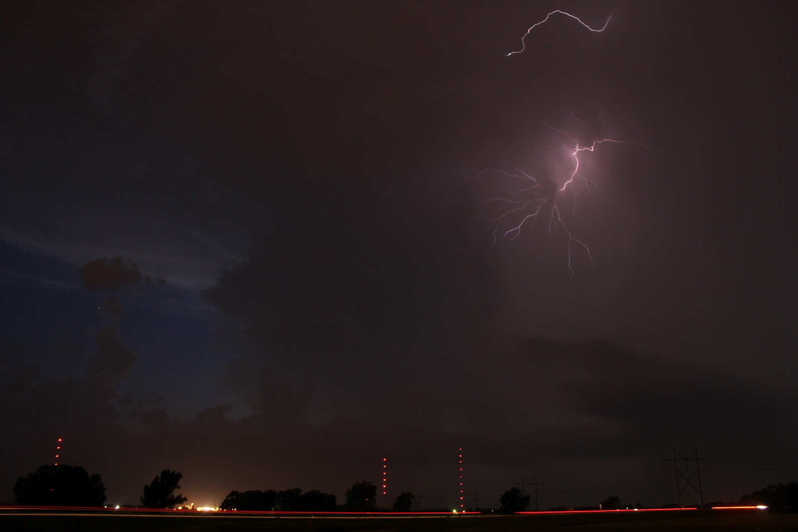
And then stopped for a few lightning shots near Windthorst, Texas...


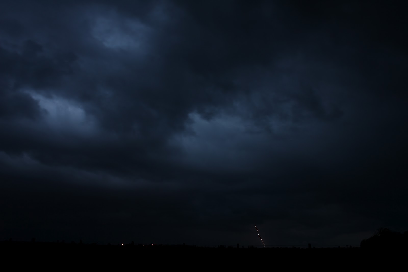
We then decided to set up in Henrietta, Texas to let the storm wash over us. There we saw very frequent cloud to ground lightning, wind gusts to about 40mph and some more dime to perhaps nickle sized hail. (Not to mention some very heavy rain, probably over an inch or so in 30 minutes).


After the storm died down we drove to Wichita Falls Texas for a sleep (although we did have Whataburger before we went to bed, mmm mmm, one of my favorite burger places - originated in Texas).

---------- morning of 12 June ---------------

We woke up in Wichita Falls, Texas this morning (Tuesday morning) and are heading towards the Texas Panhandle (Amarillo) or eastern New Mexico to intercept this afternoon's/evening's storms.

This is probably our best shot at a tornado so far this trip, although it is still a very small chance (SPC has a 5% risk). However, supercells with strong gusts, BAH (big ass hail) and another good lightning show are almost a guarantee again later though.

I'll try to update from the road.

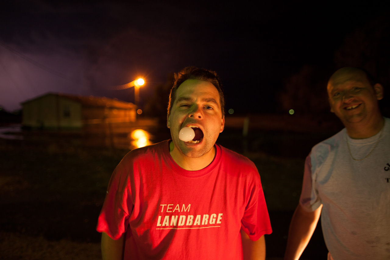
Oh, and hello from our friendly friend Mr. Grasshopper:


Monday, June 11, 2012

10th June 2012: Isolated Supercell From Birth to Death

We woke up in Okarche, Oklahoma and after a good chat with Pete's buddy Dave about the day's weather set-up we decided to make our way northwards into Kansas and initially set up near Newton just north of Wichita. We had lunch there (at Braums - a great fast-food burger place that I reckon serves the greatest milkshakes on Earth). After that we drifted northwards to a place called Roxbury where we watched this isolated supercell thunderstorm break the capping inversion (the only storm that did on Sunday in central Kansas - so we felt very good about our forecast target working out for the day). I took a time-lapse of the storm developing...(I'll try to get it into HD at some point)...


After watching it from afar we drove closer to the base and got some really great structure, near Canton, Oklahoma. We drove under the anvil and saw some very well developed mammatus cloud...


And the rain free base (updraft of the storm - the bit of brighter coloring under the storm) along with a nicely tilted updraft - indicating a healthy supercell structure. You can also see the back-sheared anvil as well - the grey around the top of left of the picture with the blue sky underneath it...


We were enjoying taking some pics of this isolated cell...


We also got a very beautiful sunset through the edge of the storm under a corn field as well...


 The storm also looked as though it was trying to produce a small funnel at one point, but we were probably too far away to decipher whether it was a funnel or just scud cloud being sucked into the storm. 


  and this was a little later...


After dark we were treated to a nice lightning show for about half an hour before the storm completely collapsed. In fact, it was probably the fastest I have seen a storm go from a healthy looking supercell (in person and on radar) to almost nothing at all. So we were very lucky to be on it from start to finish. Here are a few lightning shots from just north-west of Wichita, KS.


Today we are heading southwards to play around with the remnants of this cold front that looks like it will be draped across southern Oklahoma and northern Texas along the Red River. Looks like storm may not break the cap/inversion until close to dark, so it may end up being another lightning day - but at least there will be something to chase.

Looking forward to the rest of our chase days, the tornado risk seems to be pretty low - however there appears there will be the risk of some thunderstorms/supercells on many of the days, so fingers crossed we will still see some nice storm structure.


Saturday, June 09, 2012

9th June 2012 - Travel Day...

Nothing much to report weather wise today. However, I will officially say it was my 4th day in a row to see lightning, as we saw in the distance some flashing of lightning along the sea-breeze front off of the coast of Texas in the Gulf of Mexico at around 5am this morning as we drove northwards out of SE Texas. This was my mother's final bit of advice to us before we left SE Texas in her car!  (Thanks Mom, by the way)...


Today we needed to drive to Okarache, Oklahoma (central OK) to meet up with fellow chase partner Pete and get in position for some potential chasing on Sunday afternoon/evening across parts of eastern Kansas.

Okarache is a great little town - quintessential Great Plains town with oil derricks pumping around the outskirts of town and an awesome little eats/bar place called  Eischen's Bar in which the whole town seems to take pride in going to - all walks of life where in there enjoying themselves. A very good vibe - made me smile just sitting in there looking around. Definitely Americana at it's best.  (Pete on the left and Dan on the right enjoying themselves).


Right now it looks like the target area is somewhere just north of Wichita, Kansas. Strong instability and an approaching cold front will be the main triggers for severe thunderstorms later in the day in that area, however only marginal shear values will probably limit the risk of supercell tornadoes. Nevertheless it has the potential to be a fun chase day.  I'll update again in the morning before we leave the hotel.

Friday, June 08, 2012

8th June 2012 - Thunderstorm gust front and lightning...

Well yet again we were treated with another sneaky bit of thunderstorm action across southeast Texas this evening...this makes 3 days in a row for me to see lightning (1 in England and 2 in Texas) - so I am feeling pretty good! I have created a Facebook album to link more pictures as it's hard to share them all on here - you can access that by clicking My Storm Chase 2012 Facebook Album...

Here are a few that show what kinda stuff we saw today...


Tomorrow I'm not expecting to see lightning for a 4th day in a row...it's more of a travel day coming up. The plan is to get up early from SE Texas and make our way to near Oklahoma City to pick up Pete - and then probably drive into Nebraska to get ready for some chasing action on Sunday. That's potentially about 17 hours of driving coming up on Saturday! Still a little uncertain as to where and how much of a risk thunderstorms will be, but it looks like there will at least be a slight risk of thunderstorms by the SPC on most day from Sunday through the coming week - so hopefully many more pics to come!